One of the navigational officer’s duties during route planning and execution is to check the route for the presence of temporary hazards: new rigs, seismic vessels with a 10 km cables, drifting containers, oceanographic works, fire exercies, etc.
If a vessel is in the same area for a long time, then tracking routine messages by NAVTEX or INMARSAT C is not difficult, and you are usually well familiar with the situation. However, if you transfer to a new area, you need to get the most updated information for the passage plan.
So, usually ship obtains NAVAREA by INMARSAT C, and the Coastal Navigational Warnings by NAVTEX. You might also get NAVTEX messages directly on the ECDIS screen, but it might not always work. Coastal Messages, actually, are no less important, and sometimes even more, because they reflect immediate problems or dangers within the coastal voyage.
Nowadays, more and more ships have internet access and a lot of sailors access to internet in ports from their mobile devices.
So, basing on the theory that laziness is driving mankind, and specifically the type of laziness that makes us think about how to simplify one's life, we may do as follows.
Having the internet access, you can check the current NAVAREA warnings and Coastal navigational warnings in a given navigation area.
1st useful link:
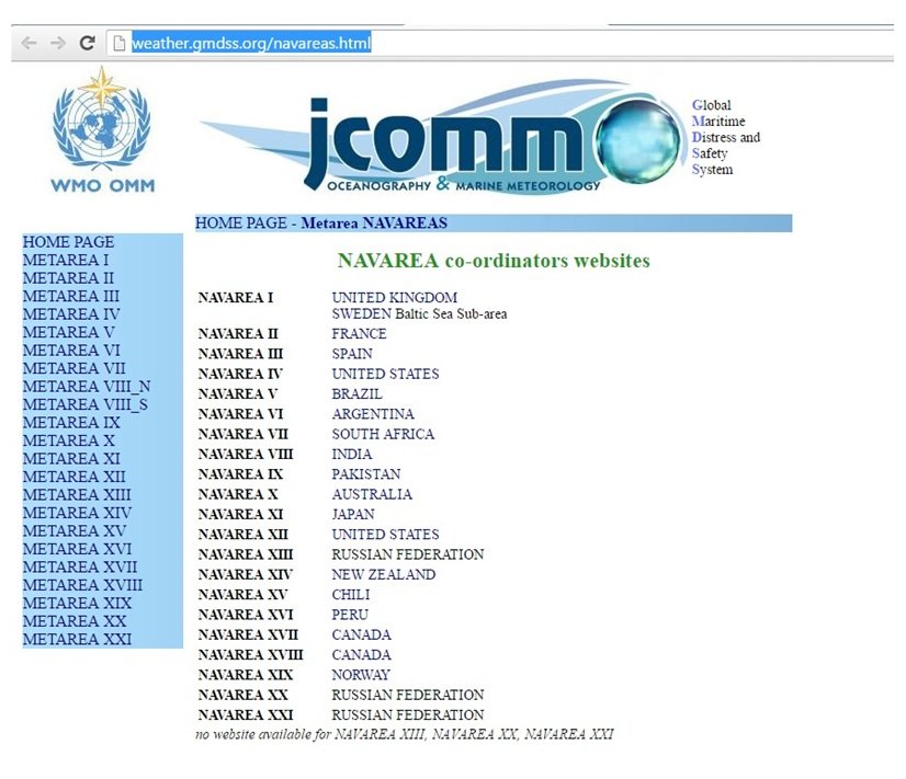
NAVAREA co-ordinators websites

On this web-site you can find links to all NAVAREA coordinators sites, except for the Russian Federation. As indicated on the website, the RF does not provide such information.
Down below I listed all the links by area, as not all links on the weather.gmdss.org site are convenient. Some are in Spanish or French, and some may not always be immediately found.
NAVAREA I: United Kingdom Hydrographic Office
NAVAREA IV, XII: National Geospatial Intelligence Agency
NAVAREA V: Brazilian Directorate of Hydrography and Navigation
NAVAREA VI: Argentina Naval Hydrographic Service
NAVAREA VII: South African Navy Hydrographic Office
NAVAREA VIII: Indian Naval Hydrographic Department
NAVAREA X: Australian Maritime Safety Authority
NAVAREA XI: Hydrographic and Oceanographic Department Japan Coast Guard
NAVAREA XIV: Land information New Zealand
NAVAREA XVI: Peru Directorate Hydrography and Navigation
NAVAREA XV: Chilean Navy Hydrographic and Oceanographic Service
NAVAREA XVII & XVIII: Canadian Coastguard
NAVAREA XIX: Norwegian Coastal Administration
Following these links you can find both NAVAREA messages and Coastal Warnings.
For example, the British Admiralty site:

There is also "Low Bandwidth" button on the Admiralty site, specifically for the users with slow internet connection.
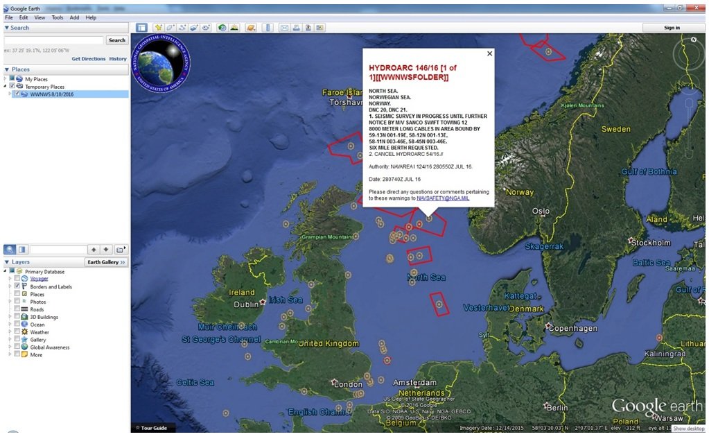
What worth special acknowledgement is the NAVAREA IV: National Geospatial Intelligence Agency website.

From this site you can download a file with all the NAVAREA warnings (for all regions) and display their positions, as well as frames, on Google Earth.

The layer for displaying the NAVAREA on the Google Earth can be turned on here:

Dear colleagues, I hope this information was useful for you. Save your time, work more efficiently and follow us.
Grow with us!
Register with Learnmarine today and become a part of a professional maritime society
Wish you calm seas and best regards!
For the latest news and updates you may also follow us on Facebook or Instagram.
Learnmarine is a provider of custom-made online and in-class training as well as competency assessment for the maritime industry.
Comments